As Hilary made landfall on Sunday on the Baja California peninsula, the National Hurricane Center has warned of “catastrophic and life-threatening flooding” across the region.
In the realm of weather forecasting, precision is paramount. Imagine having the ability to predict the movements and intensities of hurricanes with greater accuracy, potentially saving lives and minimizing damage.
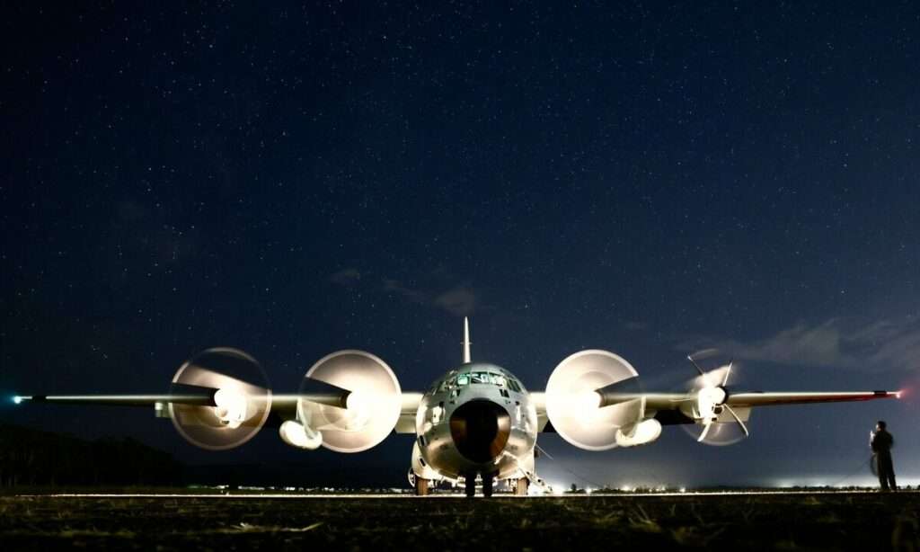
Meet the extraordinary individuals who make this possible – the Air Force Reserve’s remarkable “Hurricane Hunters.”
Stationed at the 403rd Wing, Keesler Air Force Base in Mississippi, these dedicated experts embark on daring weather reconnaissance missions, taking to the skies to gather vital weather data that significantly improves the forecasts provided by the National Hurricane Center (NHC).

Setting Sail into Hurricane Hilary
Flight cancellations across San Diego, Los Angeles & Palm Springs’ airports began over the weekend due to the effects of Hurricane Hilary.
Last Friday, the 53rd Weather Reconnaissance Squadron, often hailed as the “Hurricane Hunters,” took to the skies to monitor the approach of Hurricane Hilary.
[monsterinsights_popular_posts_inline]
The menace of Hurricane Hilary looms large as it recently escalated to Category 4 status. With the potential to unleash tropical storm conditions that could impact the Baja California peninsula, vigilance is imperative.
The advisory from the NHC alerts us that the storm’s effects could be felt from late today through Sunday.
If Hilary makes landfall as a tropical storm in Southern California, it would signify a historic event – the first occurrence in 84 years, according to the National Weather Service.
Furthermore, the storm’s potential to trigger heavy rainfall and flash floods has added to the apprehension, as highlighted by the NHC.

The Essential Role of the Hurricane Hunters
While satellites are undeniably invaluable in providing a plethora of information about storms, they fall short in revealing the intricate details within these meteorological phenomena.
This is precisely where the “Hurricane Hunters” step in, serving as a crucial bridge between satellite observations and the need for precise internal storm insights.
Flights typically operate into the heart of hurricanes, penetrating the eye of the storm at altitudes of around 10,000 feet, a task that requires expertise and skill.

During a mission, the aircraft collects weather data such as temperature, wind speed, wind direction, humidity, and surface pressure.
During each pass through the eye, they release multiple dropsondes at different areas in the storm, which collect weather data on its descent to the ocean surface, specifically gathering data on temperature, humidity, pressure, wind speed and wind direction.
An automated data package is sent out every 10 minutes while manual observations, such as the dropsonde data, are sent as necessary.
Gathering Data Where Data is Scarce
Navigating the vast expanses of the Pacific and Atlantic Oceans presents a unique challenge – data scarcity. The absence of radar and weather balloons in these areas hinders the collection of real-time weather information.
Herein lies the significance of the 53rd WRS crews’ vital operations. Their operations into the eye of the storm yield critical data that is otherwise unattainable.
This data, collected meticulously through multiple passes, empowers meteorologists with insights into the storm’s core, enabling them to predict movement and intensity with greater precision.
The Impact of Data Collection
The contribution of these daring missions is immeasurable. Lt. Col. Steve Burton, the 53rd WRS mission commander for the weather deployment, underscores the significance:
“By flying into the storm, crews are able to locate the low-pressure center of the storm and collect data that assists with movement and intensity forecasts. The data we collect can improve a forecast by anywhere from 15-25 percent.”
Dropsondes and Automated Observations
The technology at the Hurricane Hunters’ disposal is impressive. As the aircraft ventures into the storm’s eye, it releases dropsondes at various points within the storm.
These ingenious devices descend to the ocean’s surface, gathering crucial data on their journey. This data encompasses temperature, humidity, pressure, wind speed, and wind direction.
Alongside these automated observations sent every 10 minutes, manual dropsonde data is transmitted as required, providing a comprehensive and continuous stream of information.
Having commenced reconnaissance flights on Friday August 18, the Hurricane Hunters flew a last mission to collect weather data on Hurricane Hilary on Sunday August 20.

Click the banner to subscribe to our weekly newsleter.


